seattle.ad

47°36′N 122°20′W · an unofficial invitation

Seattle,
by water.

Welcome aboard. Seattle is a city you arrive at by water, with mountains on two sides and the Sound in between. An unofficial invitation: ten places, its story, and a ferry you can steer.

Seattle keeps Pacific time.

The red line is the ferry to Bainbridge Island: about 35 minutes from Colman Dock to Eagle Harbor.

Ten marks on the chart

Ten places worth the trip

From the market at the water's edge to a garden on the lake. Scroll, and the chart sails along the shore to each one.

  1. Pike Place Market

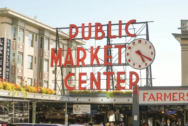
    Large red letters reading Public Market Center beside a round white clock, above the market arcade under a pale sky.
    Photo: Angel Ceballos, Unsplash

    Pike Place Market opened on August 17, 1907, a damp Saturday, when eight farmers sold out to a crowd of nearly 10,000 shoppers. In 1971 Seattle voted to save it from the wrecking ball, and the neon Public Market Center sign and clock have glowed over the entrance since 1937.

    Open in Google Maps
  2. The waterfront

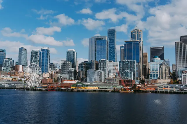
    Downtown towers under a blue sky across dark blue water, with the white Ferris wheel and the low piers along the shore.
    Photo: Josh Hild, Unsplash

    Where a double-decker highway stood until 2019, a 20-acre Waterfront Park now runs along Elliott Bay from Pioneer Square to Belltown. Overlook Walk carries you down nearly 100 vertical feet from the Market to the water. Downhill, for once.

    Open in Google Maps
  3. Kerry Park's view

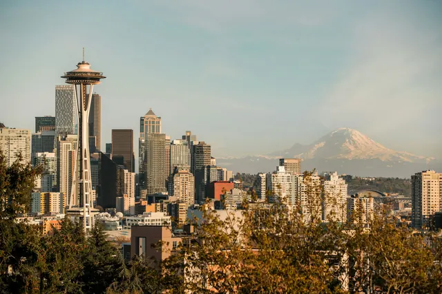
    Downtown towers in warm evening light seen from Kerry Park, with snow-capped Mount Rainier in the haze to the right and autumn trees in front.
    Photo: Toan Chu, Unsplash

    On Queen Anne's south slope, Kerry Park gives the postcard view: downtown, Elliott Bay, and Mount Rainier whenever the clouds allow. Albert and Katharine Kerry, who lived nearby, gave the land to the city in 1927.

    Open in Google Maps
  4. The Ballard Locks

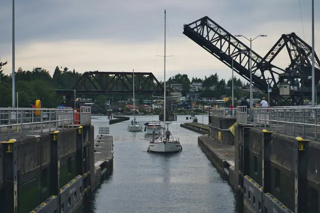
    A white sailboat in a narrow concrete lock chamber, with a raised black steel railway bridge behind it and green hills beyond.
    Photo: Doctor Tinieblas, Unsplash

    The locks lift boats between salt Puget Sound and the freshwater lakes, about 20 feet higher, and have done since 1917. Beside them, a fish ladder of 21 steps lets salmon climb home while you watch through underwater windows: sockeye in July, chinook in late August, coho in late September.

    Open in Google Maps
  5. Discovery Park

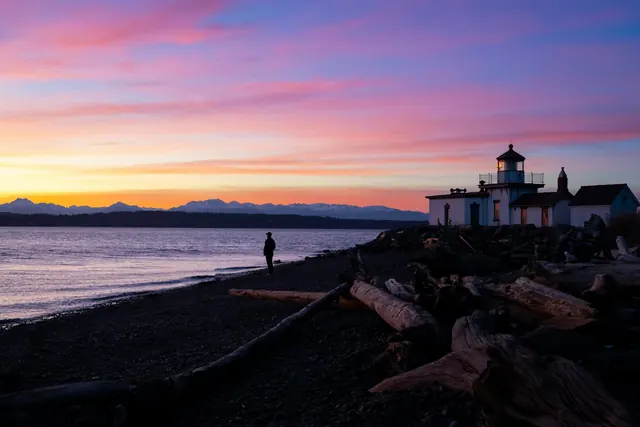
    A pink and orange sunset over calm water and distant mountains, with the small white West Point Lighthouse and driftwood on the beach.
    Photo: Eddie Zhou, Unsplash

    Seattle's largest park: more than 500 acres of forest, meadow and sea cliff on Magnolia Bluff, with two miles of protected beach. At the bottom of the bluff, the little West Point Lighthouse has marked the way into Elliott Bay since 1881.

    Open in Google Maps
  6. Alki Beach

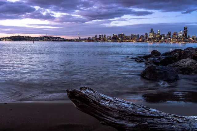
    A driftwood log on dark sand in blue twilight, with the lit downtown skyline across Elliott Bay under purple clouds.
    Photo: VAL V, Unsplash

    Two and a half miles of sand and path from Alki Point to Duwamish Head, facing the Olympics and a steady parade of ferries. The Denny Party came ashore here on November 13, 1851, in pouring rain; Si'ahl's people helped them through that first wet winter.

    Open in Google Maps
  7. Fremont

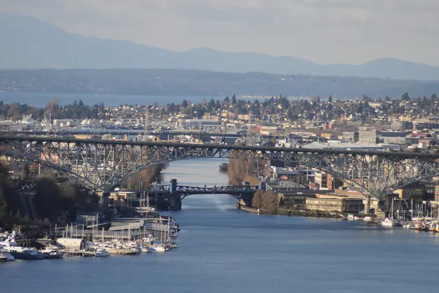
    The Fremont Cut lined with moored boats, passing under the tall arch of the Aurora Bridge and the low Fremont Bridge, with the Olympic Mountains in the distance.
    Photo: Joe Mabel, CC BY-SA 3.0

    On the north shore of the Ship Canal, Fremont modestly calls itself the Center of the Universe. Under the Aurora Bridge lives the Fremont Troll, built in 1990 and clutching a real Volkswagen Beetle; in 2005 the city renamed his street Troll Avenue North.

    Open in Google Maps
  8. Gas Works Park

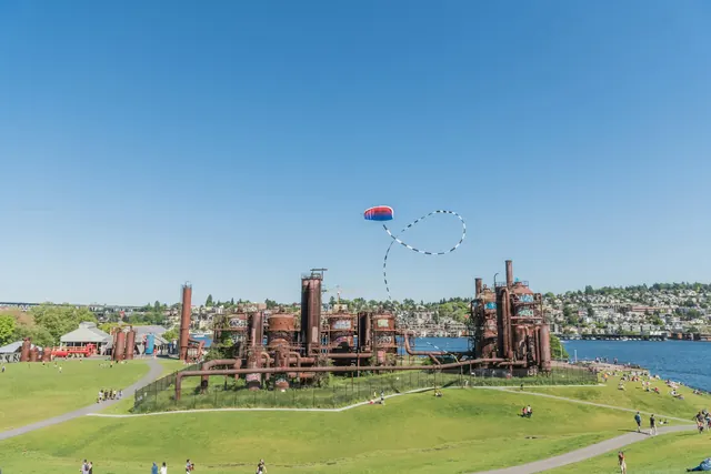
    Rust-red towers and pipes on a grassy hill, people on the lawns, a kite in a clear sky, and Lake Union behind.
    Photo: alex°, Unsplash

    The rusted towers of a plant that made the city's gas from 1906 to 1956, kept by landscape architect Richard Haag instead of torn down. Climb Kite Hill for a wide view across Lake Union to downtown.

    Open in Google Maps
  9. The Washington Park Arboretum

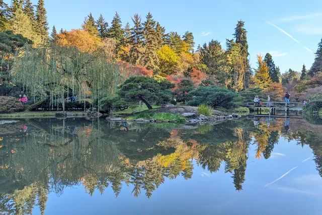
    A mirror-still pond in the Seattle Japanese Garden reflecting orange, red and yellow autumn trees, with a weeping willow and a small wooden bridge.
    Photo: SounderBruce, CC BY-SA 4.0

    230 acres on Lake Washington, run together by the University of Washington and the city, free and open every day. Its grand walk, Azalea Way, was once a horse-racing track, and the Seattle Japanese Garden inside has been growing its koi ponds and teahouse since 1960.

    Open in Google Maps
  10. Capitol Hill

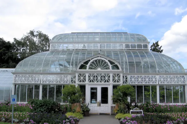
    The white-framed glass conservatory in Volunteer Park, its domed roof over double doors, with purple and pink flowers along the path.
    Photo: Rootology, CC BY-SA 3.0

    On top of the hill, Volunteer Park is an Olmsted park with a glass conservatory and the Seattle Asian Art Museum. Climb the spiral stairs of its 1906 water tower for a free view over the city. Your legs earn it.

    Open in Google Maps

Before you sail

Three things worth knowing

History From the first peoples to today Eighteen moments along the chart's edge, from the Duwamish and Suquamish to the new waterfront. Play Take the wheel Steer a heavy ferry to Bainbridge Island: mind the sailboats, give the orcas room, land it gently.